Map
Jump to navigation
Jump to search
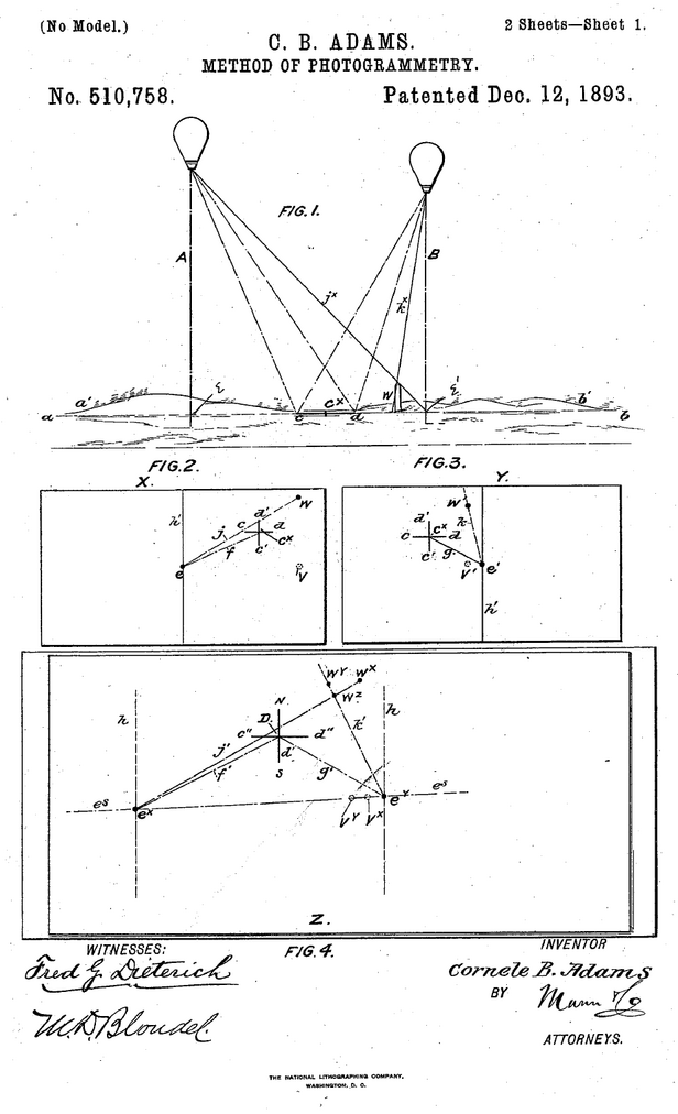


First page of illustrations from Patent US-1893-510758.

Illustration in the 1918 Textbook of Military Aeronautics.
Maps can be used for aircraft navigation; aircraft are also useful for generating and improving maps thanks to their vantage point and mobility.
| Enclosing categories | Simple tech terms |
|---|---|
| Subcategories | |
| Keywords | Photography, Navigation, DE 42n.9, USPC 33/1A, IPC G01C11/00, CPC G01C11/00 |
| Start year | |
| End year |
This wiki has 7 patents in category "Map".
Other techtypes related to Map: DE 42
Patents in category Map
- Patent US-1893-510758 (English title: Method of Photogrammetry, Inventors: Cornele Berrien Adams, Filing date: 1893-02-09)
- Patent AT-1903-31973 (English title: Procedure for producing accurate layer-maps: maps and military plans of the ground from kite or balloon photographs, as well as artificial photographics from aboard a ship, Inventors: Theodor Scheimpflug, Filing date: 1903-10-23)
- Patent DE-1908-222386 (English title: Procedure for producing accurate layer-maps from photographs, Inventors: Theodor Scheimpflug, Supplementary to patent: Patent AT-1903-31973, Filing date: 1908-01-30)
- Patent FR-1911-432971 (English title: Aero-cartoscope for communication, Inventors: Paul Fugairon, Filing date: 1911-08-04)
- Patent DE-1911-248102 (English title: Apparatus for marking a particular location on a movable map attached to rollers, Inventors: Paul Fugairon, Supplementary to patent: Patent FR-1911-432971, Filing date: 1911-08-09)
- Patent FR-1912-442633 (English title: Panoramic photography apparatus, Inventors: Auguste-Blaise Baron • Paul-Eugène Mesplès, Filing date: 1912-04-17)
- Patent DE-1916-304367 (English title: Method and apparatus of aerial topographic land-surveying for map production..., Inventors: Max Gasser, Filing date: 1916-12-16)
Publications referring to Map
- Publication 10659, 1817, Narrative of the aerial voyage of Mr. William Sadler across the Irish Channel (Simple title: A narrative of the aerial voyage of Mr. William Sadler across the Irish Channel from Porto Bello Barracks in the neighborhood of Dublin on Tuesday, July 22, 1817; to which is annexed a chart of the channel showing his course and place of descent)
- Fonvielle, 1898, Carte synoptique des Vents lors du départ d'Andrée (Simple title: Synoptic Map of the Winds during the departure of Andrée, Journal: L'Aérophile)
- Publication 13076, 1908, La carte der canalisations électriques aériennes (Simple title: The map of aerial electric pipes, Journal: L'Aéronautique)
- Publication 248, 1908, Aëronautische Landkarten (Simple title: Aeronautical maps, Journal: Wien. Luftsch. Zeit.)
- Aero Club of America, 1911, A. C. A. aeronautic map of western Long Island (Simple title: A. C. A. aeronautic map of western Long Island, Journal: Aircraft)
- Publication B2p0836e19, 1911, An international aero map (Simple title: An international aero map, Journal: Scient. Amer.)
- Moedebeck, 1911, Aeronautical maps of German Federation (Simple title: Aeronautical maps of German Federation, Journal: Vestnik Vozdukhoplavaniya)
- Langhans, 1913, Vogels Karte des Deutschen Reiches und der Alpen Länder im Massstab 1: 500.000 (Simple title: Vogel's map of the German Empire and the Alps in scale 1: 500,000, Journal: Wien. Luftsch. Zeit.)
- Publication B2p0836e11, 1913, An aviation map of the world and marks for aviators. Based on the international world map (Simple title: An aviation map of the world and marks for aviators. Based on the international world map, Journal: Scient. Amer. Suppl.)
- Roncagli, 1913, For an aeronautic map of the world . . . Translated by Henry Woodhouse (Simple title: For an aeronautic map of the world . . . Translated by Henry Woodhouse, Journal: Flying)
- Woodhouse, 1914, To make a standard aeronautical map of the world and an efficient aeronautical map of the U. S (Simple title: To make a standard aeronautical map of the world and an efficient aeronautical map of the U. S, Journal: Flying)
- Publication B2p1454e03, 1914, Flying around the world (Simple title: Flying around the world, Journal: Scient. Amer.)
- Aero Club de France, 1916, Commission de cartographie (Simple title: Cartography Commission, Journal: L'Aérophile)
- Wimperis, 1920, A Primer of Air Navigation (Simple title: A Primer of Air Navigation)
- Wimperis, 1920, A Primer of Air Navigation (Simple title: A Primer of Air Navigation)
Publications referring to map
- Publication 10659, 1817, Narrative of the aerial voyage of Mr. William Sadler across the Irish Channel (Simple title: A narrative of the aerial voyage of Mr. William Sadler across the Irish Channel from Porto Bello Barracks in the neighborhood of Dublin on Tuesday, July 22, 1817; to which is annexed a chart of the channel showing his course and place of descent)
- Fonvielle, 1898, Carte synoptique des Vents lors du départ d'Andrée (Simple title: Synoptic Map of the Winds during the departure of Andrée, Journal: L'Aérophile)
- Publication 13076, 1908, La carte der canalisations électriques aériennes (Simple title: The map of aerial electric pipes, Journal: L'Aéronautique)
- Publication 248, 1908, Aëronautische Landkarten (Simple title: Aeronautical maps, Journal: Wien. Luftsch. Zeit.)
- Aero Club of America, 1911, A. C. A. aeronautic map of western Long Island (Simple title: A. C. A. aeronautic map of western Long Island, Journal: Aircraft)
- Publication B2p0836e19, 1911, An international aero map (Simple title: An international aero map, Journal: Scient. Amer.)
- Moedebeck, 1911, Aeronautical maps of German Federation (Simple title: Aeronautical maps of German Federation, Journal: Vestnik Vozdukhoplavaniya)
- Langhans, 1913, Vogels Karte des Deutschen Reiches und der Alpen Länder im Massstab 1: 500.000 (Simple title: Vogel's map of the German Empire and the Alps in scale 1: 500,000, Journal: Wien. Luftsch. Zeit.)
- Publication B2p0836e11, 1913, An aviation map of the world and marks for aviators. Based on the international world map (Simple title: An aviation map of the world and marks for aviators. Based on the international world map, Journal: Scient. Amer. Suppl.)
- Roncagli, 1913, For an aeronautic map of the world . . . Translated by Henry Woodhouse (Simple title: For an aeronautic map of the world . . . Translated by Henry Woodhouse, Journal: Flying)
- Woodhouse, 1914, To make a standard aeronautical map of the world and an efficient aeronautical map of the U. S (Simple title: To make a standard aeronautical map of the world and an efficient aeronautical map of the U. S, Journal: Flying)
- Publication B2p1454e03, 1914, Flying around the world (Simple title: Flying around the world, Journal: Scient. Amer.)
- Aero Club de France, 1916, Commission de cartographie (Simple title: Cartography Commission, Journal: L'Aérophile)
- Wimperis, 1920, A Primer of Air Navigation (Simple title: A Primer of Air Navigation)
- Wimperis, 1920, A Primer of Air Navigation (Simple title: A Primer of Air Navigation)